THE ADVENTURE COLLECTIVE FIELD NOTES
A closer look at the journey.
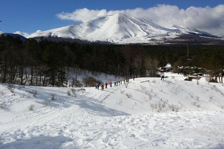
A thin trail peels away from Karuizawa’s modest inns and slips into a beech-and-conifer understory. The path rises and falls along the former Nakayama Road, where weathered stone markers and mossed irrigation moats hint at centuries of travelers. At the crest near Usui Pass the Kanto Plain spreads below; on clear mornings Mt. Asama, the Southern Alps and Yatsugatake line the horizon while a possible sea of clouds drifts beneath you.
This is a stretch of the old Nakasendo—an Edo-period inland route connecting Edo and Kyoto. The pass was long considered one of the most testing sections for packhorses and foot travelers; echoes of that effort remain in collapsed teahouse ruins and the compact, restored Sakamoto inn area. Geologically the route follows volcanic foothills and steep eroded gullies; drainage channels and narrow irrigation weirs speak to how locals shaped the slope for agriculture. Culturally, the Kumano Imperial Shrine near the border is treated as a local power spot, and small markers along the way map historic stopping points.
Practical guidance: expect 5–6 hours on trail with intermittent steep sections — plan for roughly 10–12 km and 400–600 m cumulative ascent. The trail surface alternates compact earth, stone steps and occasional mud; trekking poles and sturdy boots are recommended. Bring layered clothing, cash for the Kotonoyu onsen at the end, and a full phone battery for photos and basic navigation. Return options include local buses toward Karuizawa or trains from nearby Yokokawa; follow Leave No Trace and onsen etiquette to preserve this living route.
Things to know before you go
Start early for the views
Begin at first light to maximize clear vistas and avoid afternoon clouds on the Usui Pass viewpoint.
Wear sturdy boots
Trail alternates between stone steps and muddy sections—supportive, grippy footwear reduces fatigue and ankle risk.
Bring cash and a towel
Kotonoyu onsen commonly charges an entry fee and may not accept cards; carry small bills and a lightweight towel.
Conserve battery and carry a map
Cell coverage can be spotty; bring a charged power bank and a paper or offline map for navigation.
Your questions, answered.
How long is the trek and how hard is it?
Typical guided timing is 5–6 hours covering roughly 10–12 km with intermittent steep pitches; classified as moderate—good for hikers used to full-day outings.
Is the hot spring admission included?
The guide will bring you to Kotonoyu, but onsen admission is usually a separate local fee—bring cash and follow onsen etiquette.
How do I get back to Karuizawa?
Options include local buses from the Yokokawa area back to Karuizawa or trains from nearby stations; confirm current schedules in advance, especially on weekends and holidays.
Are there any accessibility or health restrictions?
The route is not recommended for travelers with spinal, serious heart conditions or pregnant visitors due to uneven terrain and sustained effort.