Hiroshima Prefecture Travel Guide

VAYCAI · DESTINATION GUIDE

Hiroshima Prefecture Travel Guide

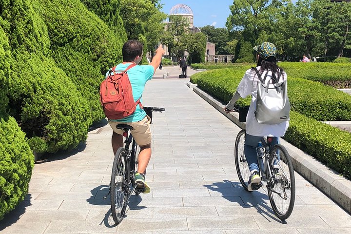
Hiroshima Prefecture stacks coastal paddling and island hopping with quiet mountain trails and canyon scrambles. Plan to combine a Seto Inland Sea ferry day with a forested hike into volcanic ridgelines, or swap a long scenic drive for a relaxed cycling loop through coastal villages. It’s a region where culture and active days sit side by side, easy to mix into a 3–7 day itinerary.

Hiroshima CitySeto Inland SeaMiyajima (Itsukushima)Chūgoku MountainsSandankyo Gorge
Explore experiences ↓

Your guide to places, experiences, and adventures.

Places to explore

Choose your next stop.

MAKE IT PART OF YOUR TRIP

Experiences in Hiroshima Prefecture.

GET TO KNOW THE PLACE

Why Visit Hiroshima Prefecture

Salt air and cedar shade meet here. From the torii that rises out of the sea to narrow canyons threaded by rivers, Hiroshima Prefecture offers compact, varied movement: paddling, hiking, cycling and short multi-modal connections that let you cover coast and mountain without long transfers. It’s ideal for travelers who want active days punctuated by local food and quiet cultural stops.

Walk into the place and you’ll notice the rhythm: ferries arriving like exhalations, pine-scented ridgelines that hold the last light, rivers that nudge you toward canyon mouths. Geologically, the Seto Inland Sea sits in a drowned-river and island archipelago, creating sheltered waters and fragmented shorelines ideal for paddling and island-hopping. The Chūgoku Mountains rise on the prefecture’s north edge, their basins feeding clear streams and carving narrow gorges. That mix of sea and uplift gives you short days of diverse scenery — coastal cliffs one morning, moss-carpeted trails the next. Expect varied footing and frequent elevation shifts; plan for traction and time for photo stops.

History and culture are woven into the landscape. Shrines and torii frame the water; historic towns preserve timber storefronts and oyster racks along the shore. The region carries modern history alongside timeless craft traditions, and local food—oysters, fresh seafood, mountain vegetables—rewards active appetites. Practically, most adventure access is straightforward by ferry, local train, and regional roads, but remote gorges and higher ridges are easier with a car. Aim to book ferries in advance for popular island hops during peak weeks and leave buffer time for weather-dependent crossings.

Plan days to stack experiences: an early tidal paddle around an island, afternoon temple visits, and a dawn hike into a nearby gorge to catch soft light on waterfalls. Weather shifts quickly in shoulder seasons; a midday squall can turn a coastal paddle into a wet lesson, so always check forecasts, wear layered protection, and have a dry-bag plan. Prioritize one longer backcountry day or a multi-stop coastal loop rather than trying to do everything. Short transfer times make it simple to pivot—switch a rainy paddle for a canyon walk or a cultural morning at a museum—and keep your itinerary flexible.

PLAN YOUR VISIT

When to go.

Best months

April, May, October, November

Weather

Spring and autumn offer mild temperatures and clearer skies for hiking and paddling; summer is warm and humid with a higher risk of storms and typhoons, and winter brings cooler, quieter conditions inland. Rain can affect ferry schedules and trail conditions.

Peak season

Peak periods are typically cherry blossom season in April and the autumn color window in October–November; during these times book ferries and accommodations in advance and start popular hikes early to avoid crowds.

Beyond the peak

Winter and early spring offer lower prices and quiet trails, ideal for solitude and birding; be mindful of reduced ferry frequencies and occasional muddy or icy trail sections, and choose lower-elevation routes if conditions are poor.

PACK WITH PURPOSE

What to bring.

optional

  • Binoculars for seabird and island watching
  • Action camera for paddling and canyon footage
  • Compact picnic kit for seaside lunches
  • Field guide or small phrasebook

essential

  • Layered clothing for variable coastal and mountain conditions
  • Hydration system or water bottle and filtration/clarification options
  • Sturdy trekking shoes with good traction
  • Sun protection (hat, sunscreen, sunglasses)
  • Offline map or GPS and a charged phone with local SIM or roaming
  • Basic first aid kit and any personal medication

recommended

  • Light rain shell as showers can roll in quickly
  • Headlamp for early starts or late returns
  • Trekking poles for steeper or slippery trails
  • Dry bag for paddling days and ferry transfers

FIND YOUR PACE

Choose your kind of adventure.

advanced

Suited to experienced adventurers seeking long ridge routes, multi-day backcountry sections, or technical canyon travel.

  • Multi-stage mountain ridge traverses in the Chūgoku range
  • Technical canyon approaches that may require scrambling
  • Long-distance coastal routes combining cycling and ferry legs

beginner

Ideal for those new to multi-modal outdoor travel who want short hikes, calm paddles, and gentle cycling.

  • Short coastal kayak or SUP on a sheltered bay
  • Easy island walks and shrine visits
  • Relaxed seaside cycling on low-traffic roads

intermediate

For travelers comfortable with day hikes, longer paddles, and moderate elevation gains who want varied terrain and some technical footing.

  • Full-day island-hopping paddle with short landings
  • Forest ridge hikes with sustained climbs and descents
  • Canyon-side walks that require steady footing

BEFORE YOU GO

Your questions, answered.

Do I need a guide or is self-guided travel feasible?

Both work well: self-guided explorers can use public transport and ferries for main islands and signed trails, while guides are helpful for technical canyon sections, multi-day backcountry routes, or to access private oyster farms and local insights.

How safe are paddling and coastal activities?

Sheltered waters of the Seto Inland Sea are generally calm, but wind and tides affect crossings; check forecasts, use a guide if unfamiliar with local currents, wear a personal flotation device, and carry communication tools.

What’s the best way to get between Hiroshima City and island destinations?

Ferries and high-speed boats connect city ports to nearby islands; schedules vary seasonally so check timetables and reserve spots when possible, especially during busy holiday windows.

How many days should I allocate to see the highlights?

A practical window is 3–7 days: two to three days for coastal and island experiences plus one to two days for mountain or gorge hikes, with extra time if you want a relaxed cycling loop or more remote canyon exploration.

Can I combine cultural visits with active days?

Yes—Hiroshima’s layout makes it easy to pair a morning hike or paddle with afternoon shrine visits, museum stops, or local food experiences without long transfers.

What if weather interrupts an outdoor day?

Have a rain pivot: swap paddling for a canyon walk, a museum visit, or a cooking class; book accommodations with flexible cancellation when possible and keep transport buffers in your itinerary.