A VAYCAI STORY · THE ADVENTURE COLLECTIVE
Staircase to the Sky: Exploring Grand Staircase-Escalante’s Labyrinth of Canyons and Hoodoos
A hard-won quiet: slot canyons, hoodoos, and cinematic desert hikes where patience pays off

You arrive on a late‑afternoon ribbon of red dirt that disappears over a lip of sandstone. The land opens in tiers: bench after bench of muted mauve, rust, and cream stair-stepping toward a horizon that looks like someone painted strata with a blunt brush. Wind gives the cliffs a patient voice—the mesas cough dust, the scrub piñon whispers, and a raven calls like a punctuation mark. This is Grand Staircase‑Escalante National Monument: 1.9 million acres of high desert where the map becomes a suggestion and travel is measured in miles of silence and geological time.
Walk any canyon here and you’re moving through chapters of Earth’s history. The monument reads like a field guide to erosion: ancient coastal sands, river deposits, and volcanic whisperings jammed vertically by tectonic time. Slot canyons—Wire Pass, Willis Creek, and the many unnamed gulches—are the hairline scars carved by flash floods. Hoodoos and amphitheaters emerge where differential cementing of layers left spires that lean into the sky. On a single day you can pass rock surfaces that are 80 million years apart in age; your legs will measure the distance, the stones will mark the epochs.
Human history is just as layered. Fremont and ancestral Puebloan peoples left petroglyph panels along hidden washes; Paiute communities and later Euro‑American settlers adapted to this austere abundance. Modern conservation is part of the story, too—Grand Staircase‑Escalante was designated a national monument in 1996 and has been the center of national conversation about use, access, and stewardship ever since. Today, local guides offer intimate access: photogenic but sensitive places like Wire Pass (flat and child‑friendly), the steep climb to Yellow Rock (a 7‑hour day for the moderately fit), and low‑impact side‑by‑side drives to Willis Creek and Bull Valley Gorge that show off hoodoos and water‑polished stone.
What the monument demands of you is attention. Trailheads are often unsigned, GPS signals fade near slickrock, and weather makes the rules here. A bluebird sky can turn into a flash‑flood hazard with thirty minutes of distant thunder; a summer afternoon can bake you. That volatility, though, is part of the reward: in late afternoon the sandstone changes mood, colors deepen, and canyons act like theaters for light.
Practical reality: the hikes here vary from flat slot walks to long scrambles. Wire Pass is primarily flat and narrow—easy for families and photographers who want soft, sculpted walls and ancient petroglyphs within a mile of the car. Willis Creek is roughly two miles of walking through a shallow, willow‑lined wash with surprising pools and rounded canyon walls—an excellent choice for people acclimating to desert travel. Yellow Rock, outside Kanab, is a full‑day commitment: expect a strenuous 7‑hour outing, significant elevation change, loose scree, and breathtaking panoramic payoff over the Vermilion Cliffs and the Grand Staircase ramparts. If you’re time‑crunched, guided full‑day tours condense geology, wildlife viewing (deer, elk, raptors), and interpretive reading of the landscape into a single, accessible day.
Gear and pacing are non‑negotiable. Good trail shoes with sticky soles matter as much as a sun hat; bring two liters of water per person for half‑day outings and more for long hikes. A light pack with layers is useful: mornings sit cool, but exposed slickrock bakes by noon. Navigation is a skill here—carry a paper map and compass in case electronic devices fail; local guide services can handle logistics if you’d rather not gamble with private routes.
Timing your visit: shoulder seasons—April–May and September–October—deliver milder daytime temperatures and dramatic color contrasts. Spring flushes desert wildflowers into washes; fall cools evenings to sweater weather. Summer means long days but also a higher risk of afternoon storms; winter brings quiet and clear light, though higher elevations can be frosty.
Cultural consideration: many of the monument’s most visited slot canyons lie on or near tribal lands. Antelope Canyon and Horseshoe Bend (often combined with monument visits by travelers based in Page, Arizona) are managed by Navajo guides—respect their rules about photography, tripods, and behavior. Leave petroglyphs and archaeological sites intact: these are irreplaceable pages in human history.
If you go with a guide, expect more than convenience—expect stories. Local naturalists and longtime residents will show you the subtle fossils, point out eagle’s nests, and read the land in ways a map cannot. If you go alone, plan conservatively: notify a friend of your route, check weather reports, and park legally at designated trailheads.
By dusk the first stars puncture the high desert’s deep blue. If you’ve hiked all day, the quiet feels earned—the land doesn’t congratulate you, but it holds still long enough that you notice the little things: the smell of creosote after wind, the way moonlight flattens sandstone into silver. Grand Staircase‑Escalante doesn’t give simple rewards. It asks for curiosity, patience, and respect. In return it offers scale—both geological and personal—and a terrain that shapes the traveler: slow, observant, and a little more careful with their footprint on the earth.
A few things worth knowing.
Hydrate early and often
Carry at least 2 liters per person for half‑day outings and more for longer hikes; water sources are scarce and unreliable.
Watch the sky
Flash floods can form miles away—if you see thunderclouds, postpone slot canyon trips and move to higher ground.
Use a paper map and compass
Cell service is spotty; bring a physical map and know basic navigation or join a guided tour.
Protect cultural sites
Do not touch or photograph petroglyphs without permission; leave artifacts in place and follow local tribal rules.
The local thread.
The area contains evidence of Fremont and ancestral Puebloan presence and was designated a national monument in 1996 to protect its unique geology and cultural sites.
A closer look
- Coyote Gulch amphitheater and natural bridges (less visited than main hoodoo areas)
- Fremont petroglyph panels near Wire Pass and smaller unnamed side slots for intimate photography
Wildlife you might see
- mule deer
- golden eagle
Managed by the Bureau of Land Management, the monument faces ongoing debates over access and protection—visitors can help by staying on durable surfaces, packing out trash, and respecting tribal lands.
A different story in every season.
spring
Spring offers mild days, blooming desert flora, and soft lighting—ideal for photographers, but watch for post‑storm runoff in slot canyons.
Good for
- wildflowers
- moderate temperatures
- photography in soft light
Plan around
- mud after rains
- variable temperatures
- increased runoff in washes
summer
Summer gives long days and clear nights, but intense heat and afternoon thunderstorms make early starts and careful weather checks essential.
Good for
- long daylight
- night sky viewing
- warm evenings
Plan around
- heat over 100°F in exposed areas
- monsoon storms and flash floods
- crowded popular sites
fall
Fall is the sweet spot for weather and color; expect warm days, chilly nights, and excellent photography windows at sunrise and sunset.
Good for
- comfortable hiking temps
- dramatic colors at sunset
- fewer crowds
Plan around
- cooler nights
- variable shoulder-season services
- shortening daylight hours
winter
Winter brings crisp air and solitude; trails can be icy in spots and some roads may close, so layer up and plan shorter outings.
Good for
- clear light for landscapes
- quiet trails
- astronomy
Plan around
- frost and occasional snow at higher elevations
- limited services
- short daylight
Pack a little wisdom.
- Hiking shoes with good tractionEssential
Sticky soles help on slickrock, loose scree, and in wet wash sections.
- 2–3 liters hydration systemEssential
Ample water reduces heat risk and dehydration on exposed stretches.
- Sun protection (hat, SPF 30+, sunglasses)Essential
High desert sun is intense and reflective off sandstone surfaces.
- Lightweight layers and wind shell
Temperatures vary widely between sun and shade; a shell handles wind and evening chills.
Through your own lens.
Shoot slot canyons in mid‑day for indirect light that brings out wall textures; carry a fast lens (24–70mm f/2.8), use a small tripod for low light if permitted, bracket exposures for high‑dynamic scenes, and seek foreground elements (willows, patterned slickrock) to add depth to wide shots.
Before you head out.
What to pack
Hiking shoes, 2–3L water, sun protection, lightweight layers — for traction, hydration, sun safety, and temperature swings.
Did you know?
Grand Staircase‑Escalante was established as a national monument in 1996 and contains geological layers that record a transition from Cretaceous coastal plains to inland deserts — an important site for paleontological and geological research.
Quick travel tips
Start hikes before 8am in summer; check BLM road conditions; book Navajo‑guided Antelope Canyon tours in advance; carry a paper map if you’ll go off main trails.
Local flavor
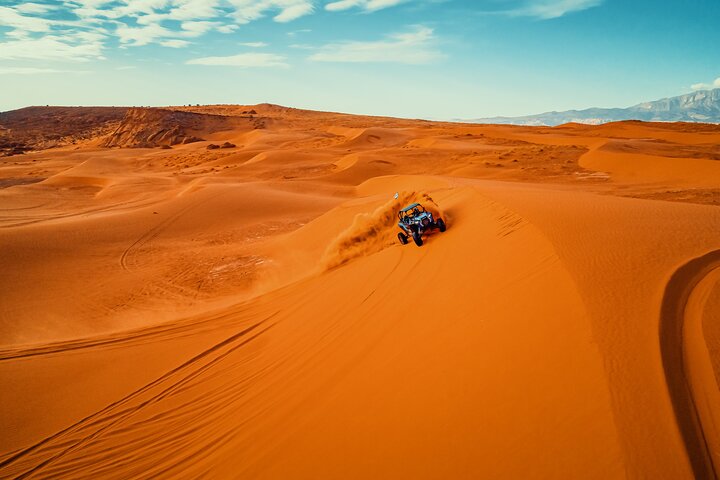
Gateway towns like Kanab and Escalante are small but vibrant—expect family‑run cafes, cowboy‑influenced menus, and outfitters offering guided hikes, UTV rides, and educational geology tours.
Getting oriented
Nearest services: Kanab (45–90 minutes); cell service: intermittent; road access: some unpaved and seasonally impassable; guided options available for slot canyons and full‑day geology tours.
Travel with care
Stick to existing trails, avoid climbing fragile fins, pack out all waste, and respect tribal lands and cultural sites; consider hiring local guides to support the regional economy and minimize impact.
The questions before the journey.
Do you need a permit to hike in Grand Staircase‑Escalante?
Most day hikes on public BLM land require no permit, but special routes, overnight backpacking, or certain trailheads may require permits—check BLM and local ranger updates beforehand.
Can I visit Antelope Canyon from Grand Staircase?
Antelope Canyon is on Navajo Nation land near Page, AZ; many guided tours combine Monument visits with Antelope Canyon and Horseshoe Bend but require separate bookings and Navajo guides.
Are slot canyons safe for families?
Many slot canyons like Wire Pass are family‑friendly when weather is clear, but never enter a slot if there is any sign of rain—flash floods can be deadly.
What wildlife might I see?
Expect mule deer, elk, coyotes, and raptors such as golden eagles and red‑tailed hawks; wildlife is most active at dawn and dusk.
Is 4x4 required to reach trailheads?
Some backcountry trailheads need high‑clearance or four‑wheel drive, especially after rain; check road conditions and consider guided tours if unsure.
How close is the nearest town for supplies and lodging?
Kanab and Escalante are the primary gateway towns—Kanab has more services and is a good base for multi‑day itineraries; Page, AZ is closer for Antelope Canyon and Horseshoe Bend visits.
Original editorial content from The Adventure Collective; some writing uses automated assistance. Conditions and operator details can change. Confirm practical information before your visit. Suggest a correction.
FROM THE PAGE TO THE PLACE
Make a little room for adventure.
Keep exploring the place and its experiences.
Looking for more options? Explore Grand Staircase-Escalante National Monument on Viator ↗
More ways to explore Utah
Other experiences in the destination; check the itinerary for the places visited.


Hurricane, United States
UTV Surf and Sand Dunes Ride at Sand Hollow State Park — 2-Hour Off-Road Adventure

Moab, United States
Edge of Canyonlands Helicopter Tour — Island in the Sky Aerial Flight (45 min)
Listed starting prices and ratings are saved information, not confirmation of availability. Final prices, dates, and terms are confirmed on Viator. We may earn a commission from qualifying bookings through sponsored links.
KEEP YOUR CURIOSITY GOING
One story leads to another.

Hanksville · United States
Where the Goblins Gather: A Practical Ode to Goblin Valley State Park
Goblin Valley is a pocket of extraterrestrial sandstone—thousands of hoodoos clustered like sentinels. This guide walks you through the geology, the best ways to experience the park, and practical tips for a safe, unforgettable trip.
Read the story ↗
Torrey · USA
Under the Fold: Exploring Capitol Reef’s Redrock Cathedrals and Secret Valleys
Capitol Reef is a compact cathedral of desert geology—narrow canyons, swooping domes, and off-grid valleys. Whether you hike under towering fins, ride with llamas into the Waterpocket Fold, or cross the Fremont River into Cathedral Valley, this is a place that rewards patience and preparation.
Read the story ↗
Alta · United States
Alta Ski Area: Worshiping the Wasatch Powder
Alta Ski Area is where powder becomes practice. Deep snow, steep bowls and a skier-first culture combine in a compact, high-altitude playground just 40 minutes from Salt Lake City.
Read the story ↗