

VAYCAI · ATTRACTION GUIDE
Corona Arch Visitor Guide
Corona Arch is a compact, high-reward outing that pairs a scenic canyon hike with dramatic sandstone architecture and river views. Stack it with a morning rafting run or an afternoon mountain-bike loop from Moab for a full, varied day of desert adventure.
MoabPotash RoadColorado RiverLa Sal Mountains
Explore experiences ↓Your guide to places, experiences, and adventures.
Get to know the place
Attractions worth a closer look.
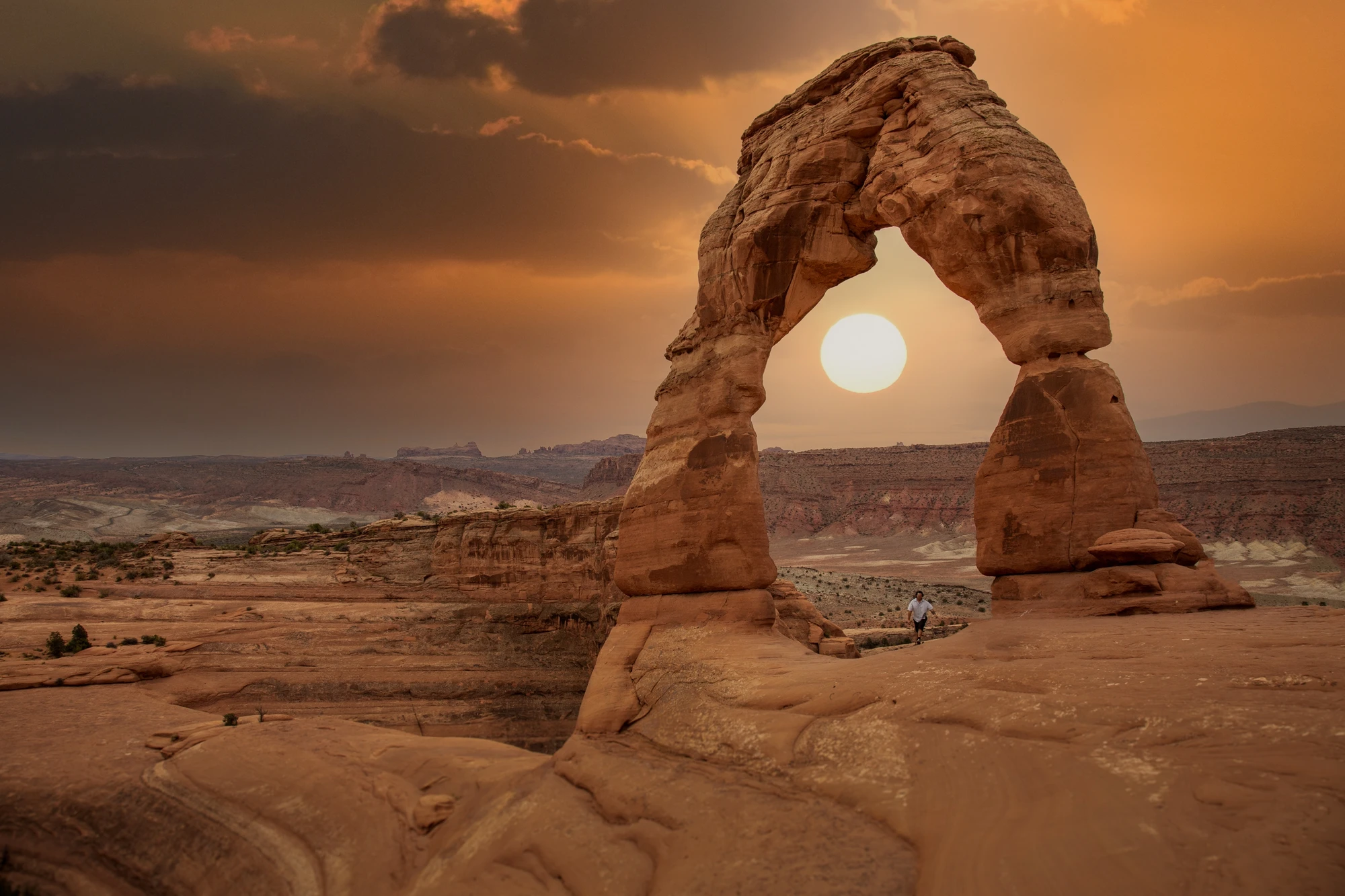
ATTRACTION
Moab, Utah, United States
Explore this place ↗
ATTRACTION
Cataract Canyon
Explore this place ↗
ATTRACTION
La Sal Mountains
Explore this place ↗
ATTRACTION
Sand Flats Recreation Area
Explore this place ↗
ATTRACTION
Fisher Towers, Moab, Utah, United States
Explore this place ↗
ATTRACTION
Utah Scenic Byway 279 Rock Art Sites
Explore this place ↗
ATTRACTION
Hell's Revenge Trail, Moab, Utah, USA
Explore this place ↗
ATTRACTION
Mill Canyon Dinosaur Trail
Explore this place ↗
ATTRACTION
Moab, Utah, USA
Explore this place ↗
ATTRACTION
Dead Horse Point State Park, Moab, Utah, United States
Explore this place ↗
ATTRACTION
Westwater Canyon
Explore this place ↗
ATTRACTION
Moab
Explore this place ↗
ATTRACTION
Canyonlands National Park
Explore this place ↗THE GOOD STUFF STARTS HERE
Experiences in Moab.

Moab, United States
Raven's Rim Red Rock Challenge: Moab Via Ferrata, Ropes & Bridge Jump
from $179USD

Moab, United States
Edge of Canyonlands Helicopter Tour — Island in the Sky Aerial Flight (45 min)
from $598USD
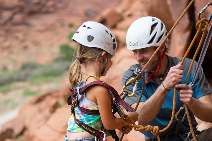
Moab, United States
Half-Day Rock Climbing in Moab: Beginner to Advanced Sandstone Routes
from $200USD
Read our guide →Booking unavailable


Moab, United States
Full-Day Fisher Towers Rafting from Moab: Family-Friendly Colorado River Whitewater
from $165USD
Read our guide →Booking unavailable

Moab, United States
Moab Half-Day Colorado River Rafting Through the Fisher Towers
from $115USD
Read our guide →Booking unavailable
Listed starting prices may vary by option, travel date and group size. Confirm the final total and availability on Viator. Sponsored links: we may earn a commission from qualifying bookings.
GET TO KNOW THE PLACE
Why Corona Arch Deserves a Spot on Your Moab Itinerary
Step across red rock that feels both ancient and immediate, and you’ll understand the pull. Corona Arch is a compact desert pilgrimage—easy to reach from Moab, visceral to experience, and visually striking enough to anchor an entire day of outdoor activity.
Corona Arch sits on sandstone shaped by wind, water and time; the arch itself is an act of geological patience, a slice of the Entrada Sandstone held aloft where a dry canyon opens to the Colorado River. The route begins on Potash Road and moves quickly from scrub and slickrock to a canyon that nudges you forward, encouraging exploration. The arch’s scale is best felt in person—stand beneath its rim and you’ll sense how the surrounding mesa and distant La Sal Mountains hold the scene in balance.
The human story here is practical and local rather than grand: a lover of the desert built a small scramble route, and over years the spot became popular with photographers, hikers and families. Unlike Arches National Park, Corona Arch is on BLM land, which changes how you plan: there are fewer services, limited shade, and a stronger need to be self-sufficient. Plan your visit around light and heat—sunrise colors the stone, late afternoon casts dramatic shadows. Bring water, check vehicle access along Potash Road, and leave time to walk slowly; the approach trail has sections of slickrock and steep steps that reward careful pacing.
From a logistics perspective, Corona Arch is adaptable. It’s a half-day classic for families and casual hikers, yet it also pairs well with river trips, mountain-biking in greater Moab, or photography-focused fieldwork. Timing is tactical—beat mid-day heat in summer by going early or late, and expect more visitors on weekends and holiday weeks. If weather rolls in, slickrock becomes slick and route choices narrow; factor a weather check into your morning routine. Overall, Corona Arch is the kind of destination that rewards minimal planning: arrive ready, move deliberately, and you’ll leave with a memorable snapshot of Utah’s desert sculpting.
PLAN YOUR VISIT
When to go.
Best months
April, May, September, October
Weather
Spring and fall offer mild temperatures and stable conditions; summers bring high heat and brief afternoon storms, while winters are colder with occasional snow that can linger on shaded slickrock.
Peak season
Late spring through early fall draws the most visitors; book lodging and guided activities early and plan to start hikes before mid-morning to avoid crowds and heat.
Beyond the peak
Winter and late fall provide quieter trails and lower rates, though some services may be limited and early-season storms can make slickrock slippery—choose routes carefully and verify access.
PACK WITH PURPOSE
What to bring.
optional
- Binoculars for river and bird viewing
- Action camera or tripod for arch photography
- Compact picnic kit
essential
- 2–3 liters of water per person
- Sun protection (hat, sunscreen, sunglasses)
- Sturdy traction footwear or hiking shoes
- Layered clothing for variable desert temperatures
- Offline map or downloaded trail route
recommended
- Light rain shell or wind layer
- Headlamp if you plan dawn or dusk visits
- Hiking poles for balance on slickrock
- Small first-aid kit
FIND YOUR PACE
Choose your kind of adventure.
advanced
A base for chaining longer desert adventures that require technical skills and strong route planning.
- Multi-activity day: biking, rafting, and arch approach
- Backcountry desert navigation and technical canyoneering nearby
- Sunrise-to-sunset photography and long exposure shoots
beginner
A short, scenic hike with some easy scrambling; suitable for active beginners comfortable on uneven terrain.
- Guided short hike to the arch
- Family-friendly photo session at viewpoints
- Scenic drive along Potash Road with pullout stops
intermediate
A fuller half-day that pairs the arch hike with nearby activities and modest route-finding on slickrock.
- Combine the hike with a half-day river float
- Mountain-biking local singletrack near Moab
- Photography-focused golden hour session at the arch
BEFORE YOU GO
Your questions, answered.
Do I need a permit or reservation to hike to Corona Arch?
No formal permit is required for the hike itself on BLM land, but check for any temporary closures or access restrictions before you go.
How long should I plan for the visit?
Allocate a half-day if you’re combining the hike with river or biking activities, or 1–2 hours for a focused approach, photos and a leisurely return.
Is the trail family-friendly?
Yes for older kids and families who are steady on their feet; expect some short scrambles and exposed sections where supervision is advised.
Can I park near the trailhead and is a high-clearance vehicle required?
Vehicle access is generally possible from Potash Road; most cars can reach the pullouts, but always verify road conditions—high clearance helps after storms.
What should I do if weather turns bad?
Move off exposed slickrock, seek lower ground or cover, and postpone the hike if heavy rain or lightning is forecast as runoff and slippery surfaces increase risk.
Are there guided options for this area?
Yes—local outfitters offer guided hikes, photography tours, and river trips; a guide is useful for combining activities and managing logistics.